Why is it dry west of the 100th Meridian?
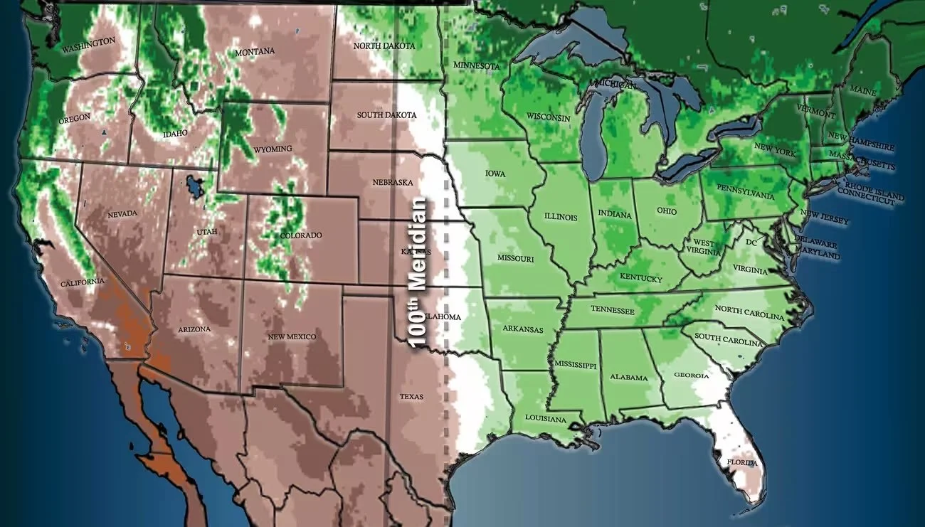
1. The Rockies form a rain shadow--the Rocky Mountains rake off almost all the moisture blowing in from the Pacific Ocean
2. Atlantic storms in winter are shunted east.
3. Gulf of Mexico moisture in summer is also shunted east due to the Coriolis effect, which deflects moving objects such as air masses to the right, or eastward, in the Northern Hemisphere.
4. To the east, 70 percent of the crop is moisture-loving corn; to the west, aridity-resistant hay is dominant.
5. The Ogallala Aquifer lies beneath it, but it is already drying up in the south in Texas and Oklahoma
6. Running south to north, the meridian cuts through eastern Mexico, Texas, Oklahoma, Kansas, Nebraska, the Dakotas, and the Canadian province of Manitoba.
7. There is only one other such major straight-line climate divide on the global map: the one separating
the Sahara Desert from the rest of Africa, also due to cutoffs of prevailing oceanic winds.
8. The statistical divide between humid and arid has now shifted closer to the 98th meridian, some 140 miles east. (In Texas, this would move it roughly from Abilene to Fort Worth.) Large expanses of cropland may fail altogether.
9. Some historians say it could be argued that the meridian influenced even wider historical trends–everything from the end of slavery (plantations could not expand past the line, weakening the South) to the development of modern firearms (settlers’ single-shot muskets couldn’t compete with native peoples’ rapid-fire arrow attacks, until the settlers became the first, best customers for new Colt repeating revolvers and rifles).
Source and more info: Krajick, Kevin, “The 100th Meridian, Where the Great Plains Begin, May Be Shifting,” Columbia Climate School, April 11. 2018, https://news.climate.columbia.edu/2018/04/11/the-100th-meridian-where-the-great-plains-used-to-begin-now-moving-east/